

Projects
Your Vision, Our Expertise, Shared Success


Client: Washington State Department of Veterans Affairs
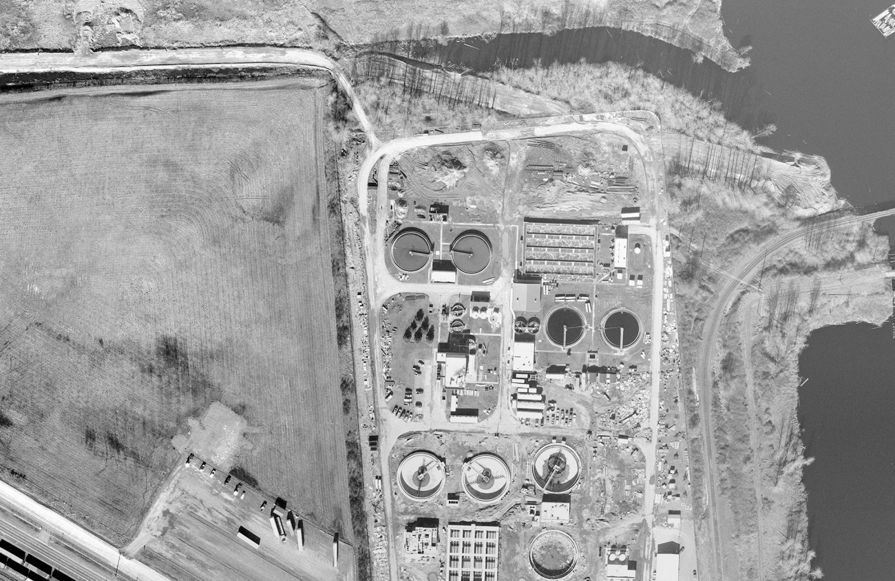
Client: Clark Regional Wastewater District
Clark Regional Wastewater District, one of the largest sewer districts in Washington State, provides wastewater services to approximately 100,000 people in Clark County. According to CRWWD, its customer base has nearly doubled in the past 20 years and continues to increase rapidly, requiring CRWWD to manage hundreds of requests to connect new single-family homes to wastewater infrastructure every year, on top of other development projects.

Client: Birch Bay Water and Sewer District, City of Port Orchard, Water System Services
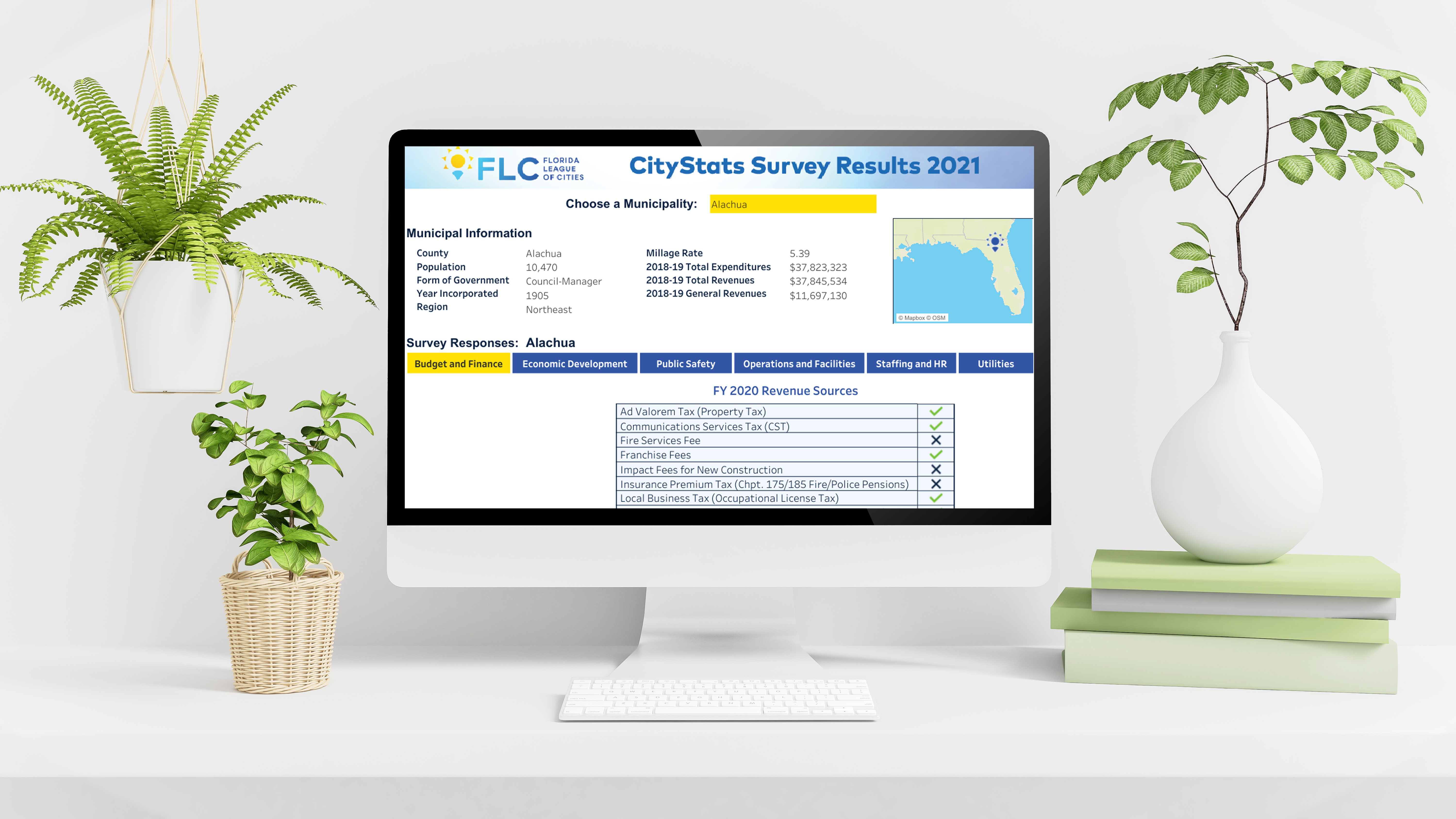
New lead line regulations from the EPA have prompted many water districts and cities to take action to improve their asset management systems and complete inspections of their water lines. To do this, they needed to create detailed inventories of all service lines and identify those that could be lead. Our clients asked us to help them of creating inventories that met the EPA document standards to comply with these new regulations. FLO started with customer information and property data to help identify non-lead and potentially lead lines.

Client: Portland Public Schools
Portland Public Schools (PPS) offers a wide array of focus programs and enrollment options for its 48,000 students across more than 80 schools. PPS was in the planning phase of opening a newly constructed middle school, reconfiguring K-8 schools to K-5 elementary schools, and re-locating focus programs, all of which had boundary change implications.
Client: Cowlitz County
As municipal solid waste is unloaded into landfill cells, the waste compacts and settles, reducing the landfill’s surface elevation. Accurately measuring and documenting how much compaction has occurred is an important task in landfill management. Although they are relatively new technologies, unmanned aerial systems (UAS) and aerial maps are the perfect tools for measuring landfill compaction accurately and efficiently.

Client: Snoqualmie Pass Utility District
Snoqualmie Pass sits in the Cascade Range at an elevation of 3015 feet, straddling the Kittitas and King counties and bisected by the important I-90 interstate. The district provides water and sewer services to over 560 homes in the area. With no existing GIS or digital asset management system in place and knowledgeable staff retiring, the district was concerned about losing its institutional knowledge.

Client: City of Stevenson
Nestled between the Columbia River to the south and the mountains and basalt cliffs of the Columbia River Gorge to the north, the City of Stevenson is strategically located just above the rapids known as the Upper Cascades in southern Washington. The City has expanded its usage of GIS via the ArcGIS Online environment to provide data access and management capabilities to more staff and ensure they can manage their own datasets.

Client: Southwest Washington Regional Transportation Council
The Southwest Washington Regional Transportation Council is the Metropolitan Planning Organization for Clark County, Washington, which is a portion of the larger Portland-Vancouver urbanized area. SWRTC is also the state-designated Regional Transportation Planning Organization for the region, which consists of Clark County, Skamania County, and Klickitat County.

Client: Pierce County
Pierce County is home to some of the most fertile farmland in the Pacific Northwest but has the highest rate of farmland loss in the Puget Sound Region. The process of protecting designated farmland is hotly contested, and past designations have left lingering questions.
As part of a multidisciplinary team, we evaluated Pierce County’s existing land use policy for designating agricultural resource lands. This evaluation process led to our recommendations for alternative approaches to better protect and support the agricultural sector and farmland protection.

Client: City of Spokane
The City of Spokane and the Northeast Public Development Authority are leading an effort to revitalize an approximately 500-acre industrial area in the Hillyard neighborhood. The city is examining approaches to improving public infrastructure as an element of its work on increasing economic opportunity for existing and new businesses in the region. The city is facing challenges to redevelopment, including historical heavy-industrial operations that have left a legacy of environmental impacts that create both actual remediation needs and a perceived stigma.

Client: Whatcom County Public Works
The Whatcom County Public Works Department provides many important services, such as stormwater management, to residents. In rainy northwest Washington State, where Whatcom County is located, a well-maintained stormwater system is vital to protecting water quality and habitat. To help fund stormwater system operations and maintenance, property owners are charged a fee based on the amount of impervious surface on their property. Every year, the County calculates a new fee for each property to ensure residents are accurately charged.

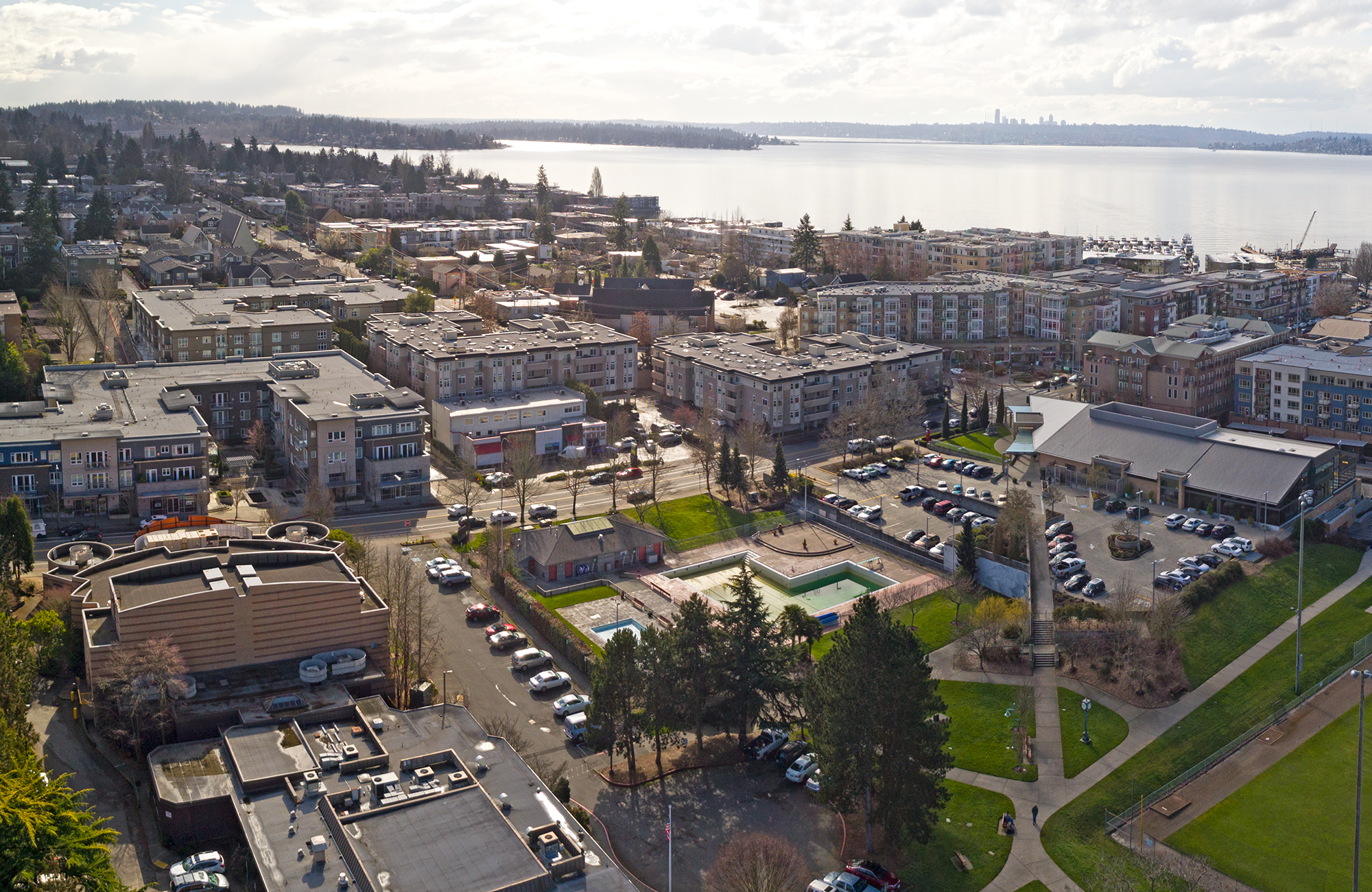
Client: City of Sammamish
The City of Sammamish, a community of around 65,000 residents, is located above Lake Sammamish on the Sammamish Plateau in King County, Washington. The City borders the communities of Issaquah to the south and Redmond to the north and is near the major urban areas of Seattle and Bellevue.
The City of Sammamish is experiencing a high population growth rate, spurring a surge of building construction in the area. City leaders identified two challenges exacerbated by the increase in development:
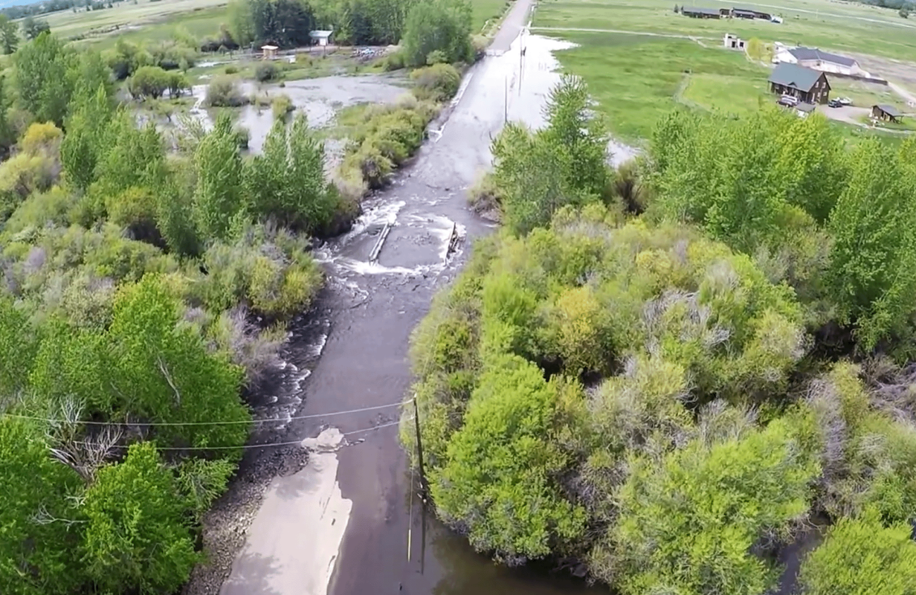
Client: City of Ellensburg
Flooding in Ellensburg, Washington, unexpectedly shut down roads and inundated agricultural fields. Ellensburg's public works director needed a quick way to document the damage before the water receded to inform future mitigation efforts and obtain a proof point for securing mitigation funding. FLO’s team flew to the area to gather aerial footage. We quickly mobilized and deployed our UAS to fly over areas most impacted by seasonal high water.

Client: Washington County
Solid waste and recycling collection within unincorporated Washington County, Oregon, is managed by private collection companies, who use legal certificates that guarantee them exclusive authority to collect waste in each geographic area. The last update of the County’s sanitary service certificates before the completion of this project was nearly 50 years ago. As the County’s landscape was changed by annexations, property development, and road construction, the County realized the certificates were no longer clearly defining reasonable service boundaries.

Client: City of Omak
City of Omak is a small rural city of about 4,700 residents in north-central Washington State. The City had a GIS-based cemetery management system, but the software running it was no longer supported by modern computer operating systems, and the City was forced to take the system offline. Office staff resorted to using paper maps, making it difficult to locate information quickly and to synchronize the maps with cemetery site records.

Client: City of Monroe
Monroe is a small city of about 19,363 residents in Snohomish County, Washington. Although it’s just 30 miles from Seattle, it retains its small-town feel. The City of Monroe knew they could use their GIS for more than creating electronic copies of paper maps to track assets for their public works department, but they weren’t sure where to start. Implementing a new asset management system presented an opportunity to assess their existing GIS and better use the tools and data they already had on hand.

Client: City of Pullman
Pullman is a small city in Eastern Washington with around 34,000 residents. It is home to Washington State University and has a strong agricultural economy known for producing wheat and legumes. Several years of rapid population growth and increasing pressure on city services motivated the City of Pullman to identify more efficient ways to track, manage, and scale up operations across city departments. Pullman’s leaders identified optimizing GIS use as a key to alleviating current issues and ensuring future use of GIS would best use Pullman’s limited resources.
Client: City of Newcastle
FLO has been working with the City of Newcastle on developing its GIS capacity, beginning with Enterprise GIS Design and Implementation and integration of its GIS data with the Cartegraph asset management system. This included the creation and publication of custom GIS services. We also built out their ArcGIS Online environment and several web GIS applications, including an Open Data Portal and a web map providing as-built document access.